Walks & Rambles
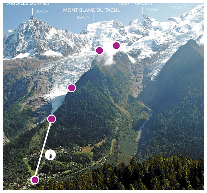
Aiguille du Midi
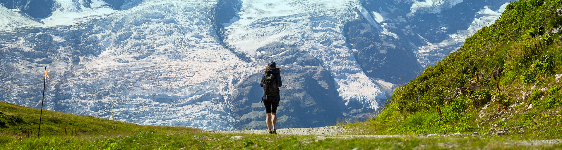
Hiking from Plan de l’Aiguille
| TPH Plan de l'Aiguille |
| TPH Aiguille du Midi |
| TC Panoramic Mont-Blanc |
Daily infos :
Locally cloudier in the first hours of the night. Variable winds, light at most places.

Morning
not available°
Afternoon
not available°
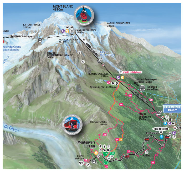
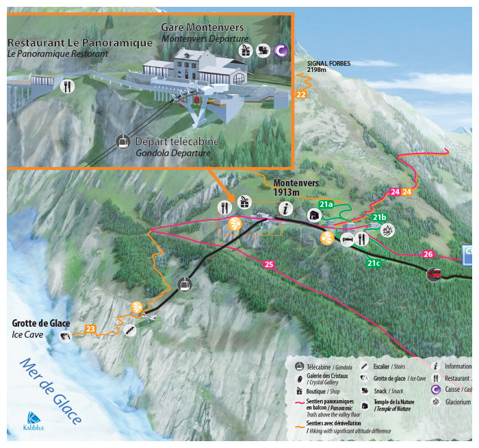
Montenvers - Mer de Glace
From le Montenvers
| Train du Montenvers |
| TC Mer de Glace |
Daily infos :
Locally cloudier in the first hours of the night. Variable winds, light at most places.
Morning
not available°
Afternoon
not available°
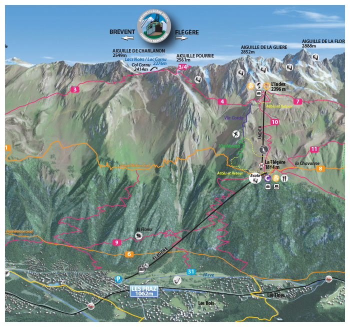
Brévent - Flégère area
From le Brévent or Flégère
| TPH Brévent |
| TC Planpraz |
| Funi 2000 |
| TC Flégère |
| TSD Index |
Daily infos :
Locally cloudier in the first hours of the night. Variable winds, light at most places.
Morning
not available°
Afternoon
not available°
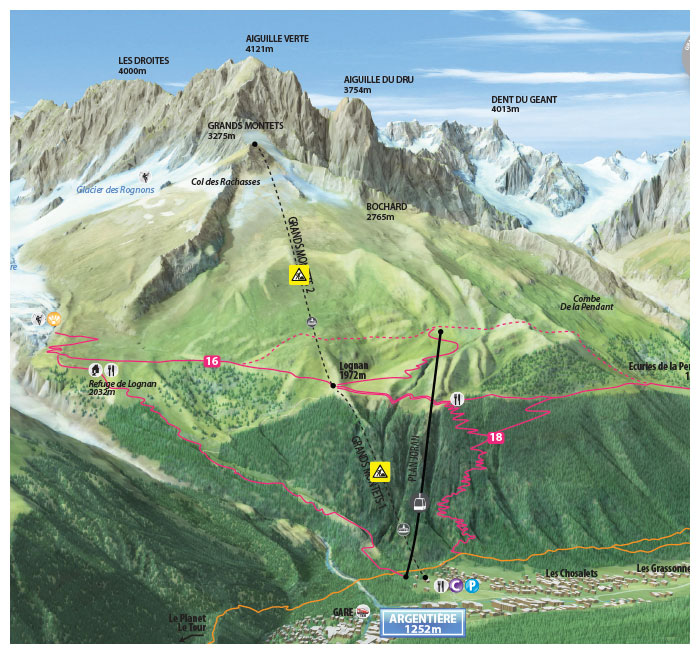
Grands Montets area
| TPH Lognan |
| TPH Grands Montets |
Daily infos :
Locally cloudier in the first hours of the night. Variable winds, light at most places.
Morning
not available°
Afternoon
not available°
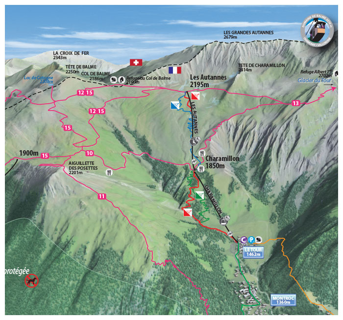
Balme area
From the top of the Autannes Chairlift
| TC Charamillon |
| TSD Autannes |
| TC Vallorcine |
Daily infos :
Locally cloudier in the first hours of the night. Variable winds, light at most places.
Morning
not available°
Afternoon
not available°
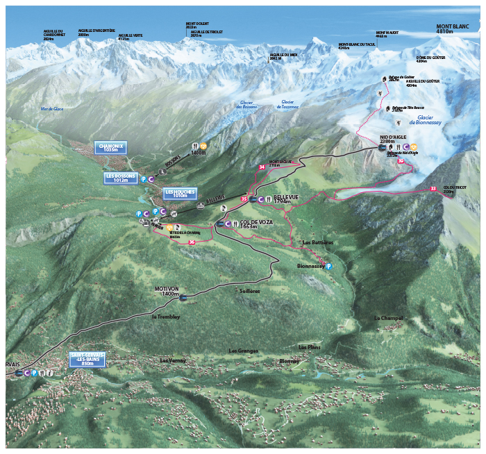
Les Houches - Saint-Gervais area
| TPH Bellevue |
| TC Prarion |
Daily infos :
Locally cloudier in the first hours of the night. Variable winds, light at most places.
Morning
not available°
Afternoon
not available°
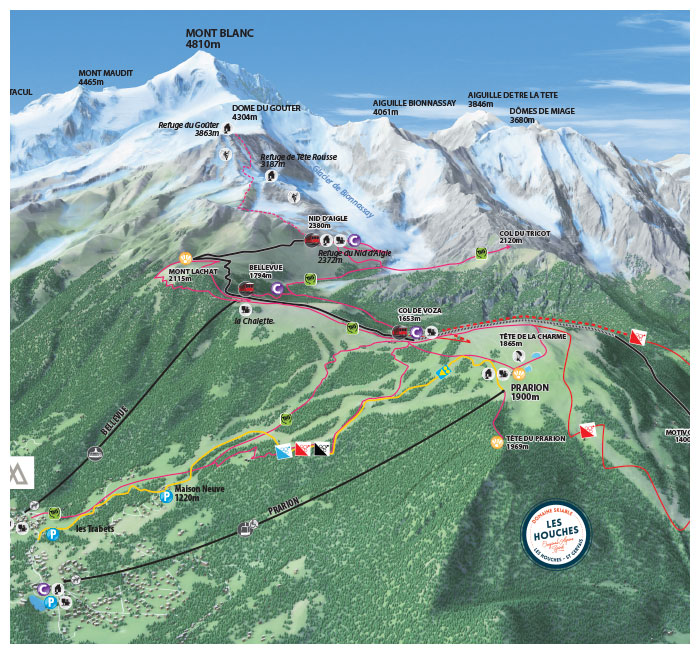
Tramway du Mont-Blanc
| Train Fayet-Col de Voza |
| Train Bellevue-Nid d'Aigle |
| Train Col de Voza-Bellevue |
Daily infos :
Locally cloudier in the first hours of the night. Variable winds, light at most places.
Morning
not available°
Afternoon
not available°
Les Bossons area
| TS Les Bossons |
Daily infos :
Locally cloudier in the first hours of the night. Variable winds, light at most places.

Morning
not available°
Afternoon
not available°